Climb-On Maps are detailed trail maps like no other and can be used for hiking or scrambling.
Our maps contain trails that are not on other maps. Here's the Climb-On Maps difference:
Our maps contain trails that are not on other maps. Here's the Climb-On Maps difference:
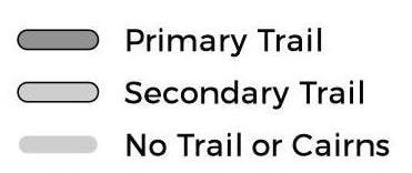
- Trails to get to rock climbs are often not "named" or officially developed trails created by the Park Service or other public land institutions. This means many of the trails on our maps are NOT on standard maps.
- Named/public trails are publicly available data which are downloaded by other map makers. This is why most maps look similar to each other (except for the color palette they may choose). In order to obtain the trail data for our maps we WALKED EVERY SINGLE TRAIL. Thats over 1800 miles for the four areas we have currently mapped (Red Rock Canyon, NV; Joshua Tree, CA; City of Rocks, ID; and Smith Rock, OR).
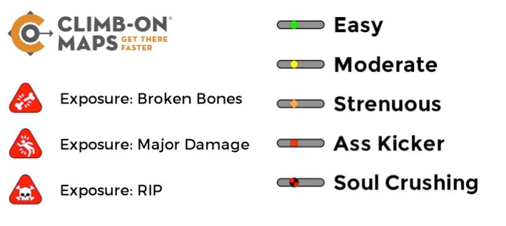
- Because we walked every single trail, we provide incredibly helpful details like trail difficulty and points of exposure.
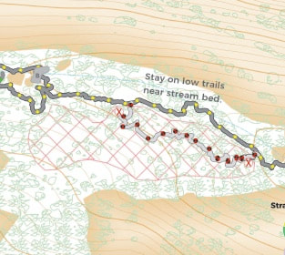
- Our maps go down to a 1:2400 scale. That's super detailed! Literally "turn left at this boulder" level of detail. Most maps are at a scale of 1:24,000, which is very bird's eye view.
- We also have multiple tiers of scales, from afar to close, so you can orient yourself. Each square or rectangle on the map indicates there is another, more detailed level.
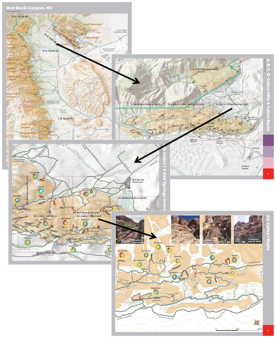
This is a sample from our Red Rock Canyon, NV map which has waterproof/tearproof loose-leaf pages (so you just bring the pages you need for the day). Joshua Tree is also in this loose-leaf style. This is because Red Rock and Joshua Tree are so large and we go down to such incredible detail. Smith Rock and City of Rocks are traditional fold-out maps.
- BE AWARE: Since these are trails to rock climbs, many of the trails are not developed. They can be steep, loose, and dangerous*. Using our maps for hiking adventures are for those who are:
- Adept at using maps/map reading
- Adventurous and well versed in wilderness travel and safety (including having the proper equipment, food, water, emergency beacons, a hiking plan that you have communicated with another person not on the hike)
- Know their limits and will not push beyond into dangerous, exposed situations
- Our maps do include the standard public trails, and can be helpful for those looking for a casual hike, but if you go off the public trail system, you need to be prepared and knowledgable.
- BE AWARE: These maps are oriented towards rock climbers, who tend to have a high tolerance for poor quality trails and conditions. Many of our trail ratings have been adjusted for that. A "moderate" rating for a trail on one of our maps may be rated as "difficult" by standard terms. Adjust accordingly to your level of fitness, experience assessing dangerous (including things like loose, large boulders), exposed conditions, and wilderness experience.
*A note about City of Rocks/Castle Rock, ID - Many of the trails are very well developed here. This fold-out map provides the most detailed representation of all of the trails in these parks.
