SUMMARY HAIKU
Ass-kicking approach
Did battle with oak tree anchor
What the FREAKING FAR!
Ass-kicking approach
Did battle with oak tree anchor
What the FREAKING FAR!
The Approach
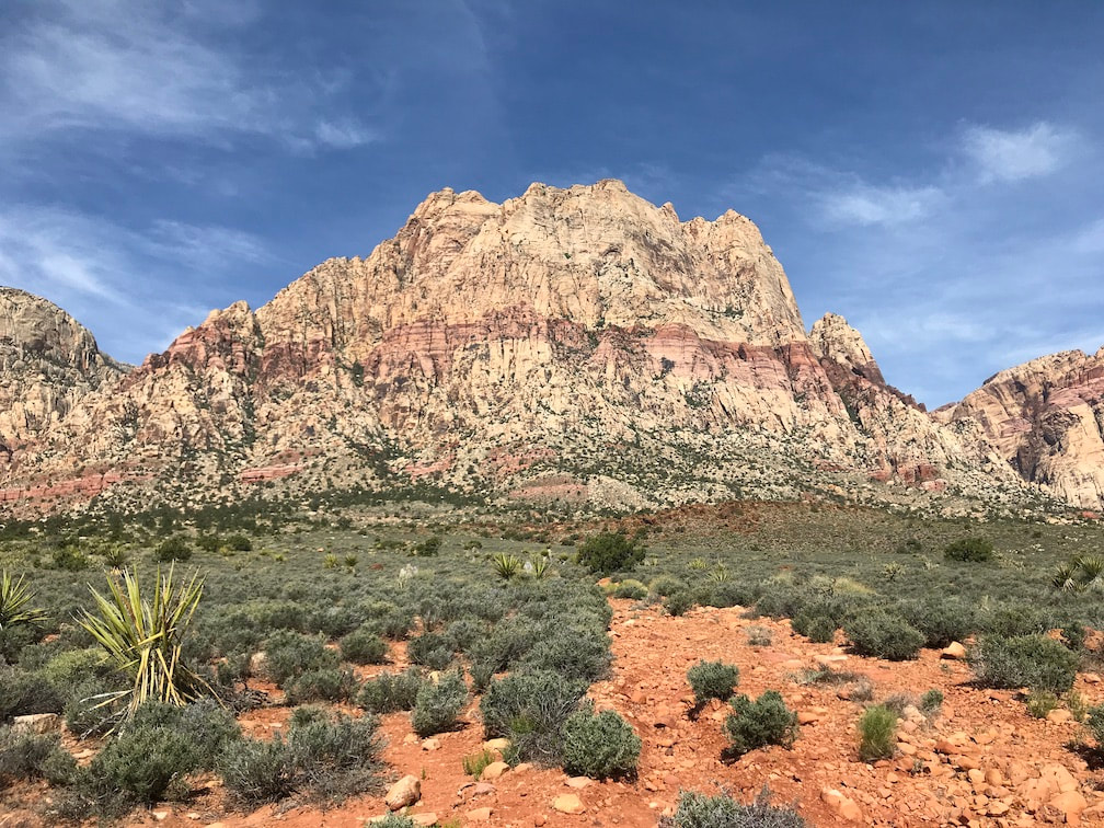
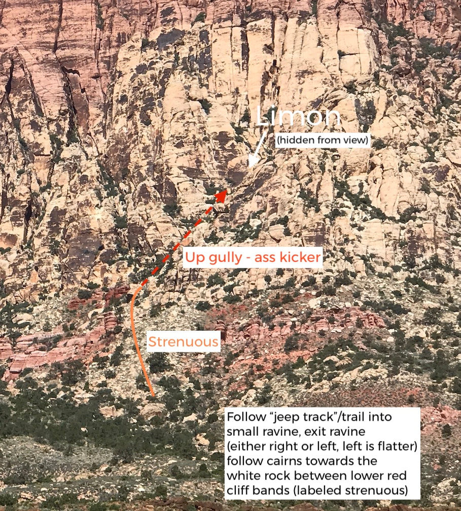
Mt. Wilson is a prominent fixture on the skyline of Red Rock Canyon because it is large and in the foreground. One might (logically) think that accessing climbs on Mt. Wilson would be shorter than having to go back into the canyons, but the reality is, accessing climbs on Mt. Wilson is a bitch. Not only is it a long walk from the road to the mountain, once you reach the base of the mountain it is maze-like, steep, loose, thorny, ass-kicking terrain - all with 40-50 lbs of gear and water on your back.
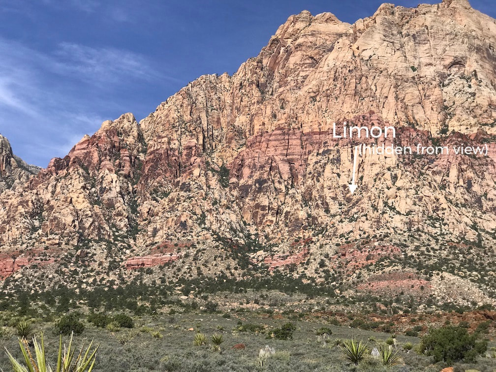
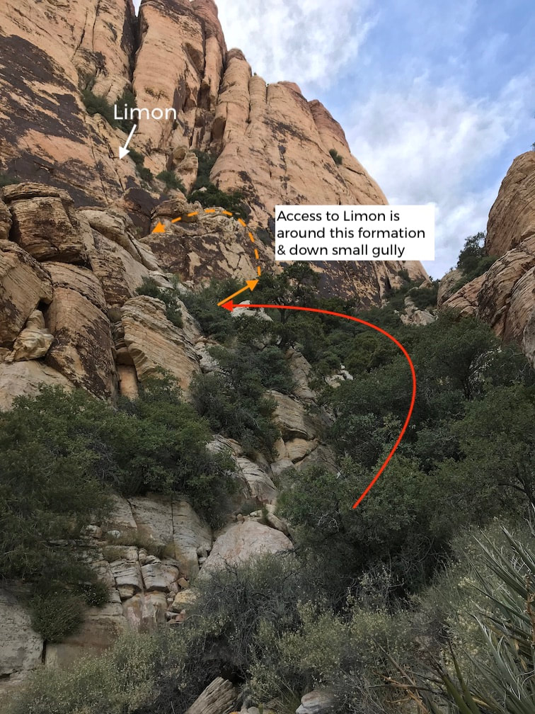
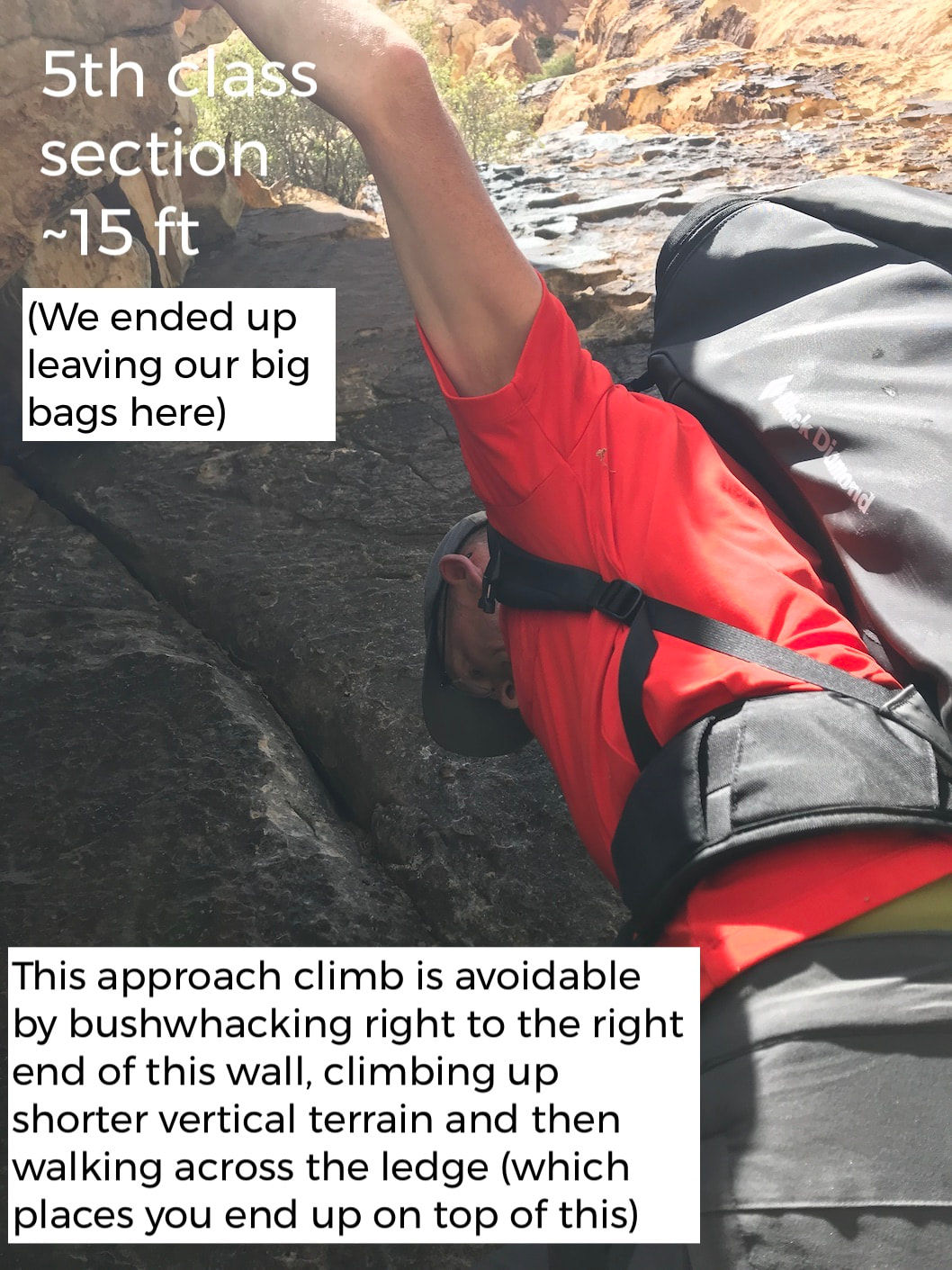
As far as Mt. Wilson approaches go, getting to Limon and the climbs on the "lower E side" of Mt. Wilson is comparatively "easy" and it still took us three strenuous hours to get there (with a few stops to take photos and to eat a snack, plus some route finding, since we've never been to this climb.) The return went a little quicker - about 2.25 hours - but I (Stef) slipped and fell on my ass twice on the steep, loose terrain - even with moving slowly and deliberately.
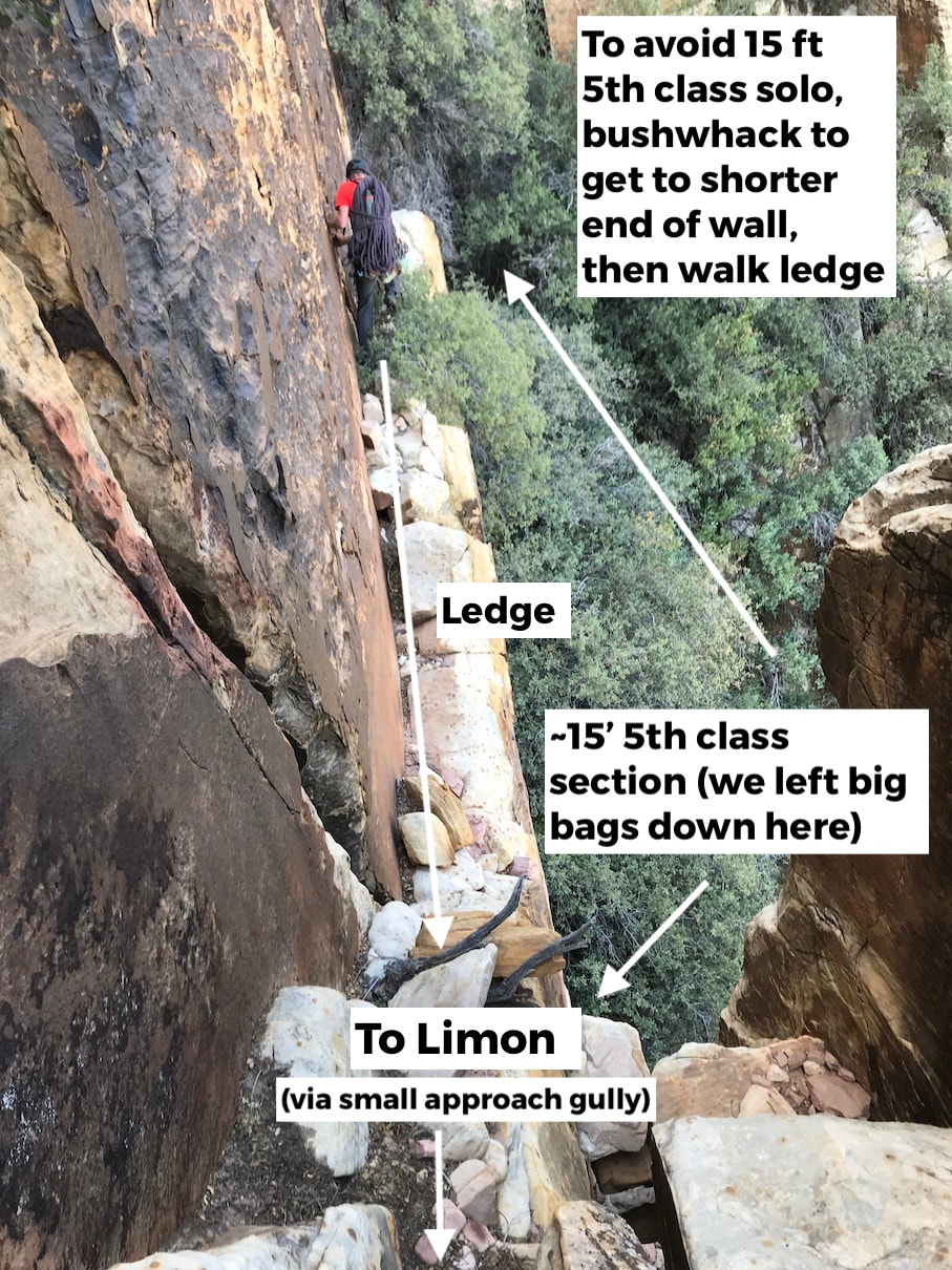
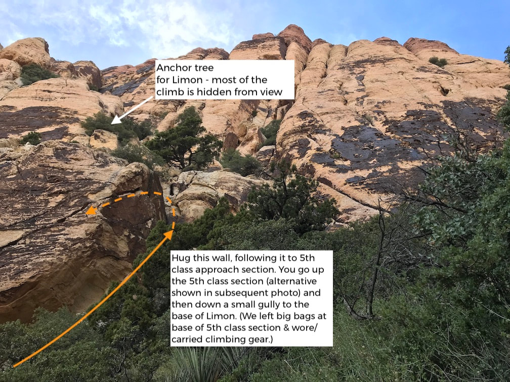
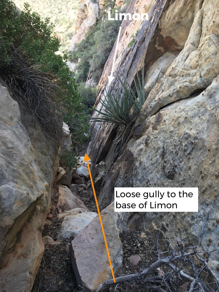
If you feel compelled to go to this area, either to climb Limon or some of the other moderate climbs on the "Lower East Side," such as Lincoln Tunnel, Movin' On Up, or Sal (Sal is immediately to the left of Limon), below are some detailed approach photos and beta to help you. (Although we mapped nearly everything in Red Rock, this is one area that's not on our currently published map. We collected the data on this trip and will be adding it on the next printing. But for now, these photos should be helpful to you!)
The Climb
|
Climb: Limon (Trad) (5.7)(1 pitches - 75') Wall: Mt. Wilson - Lower East Side Pro: doubles to #3 + small nuts for lower down Beginner Climb? No Conclusion WTF? What the FREAKING FAR!
|
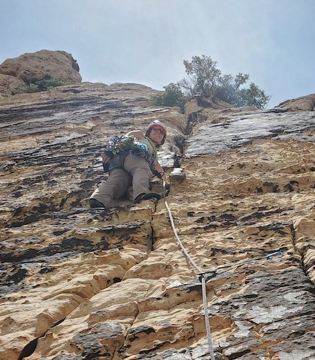
- The first ~20 feet is not really protectable. You can place some small nuts in the crack to the right (like I did in the photo) then traverse left back to the main line (if you stick only to the main crack you can place a cam low to prevent a long tumble down the rest of the cliff below but it won't protect from a ground fall). Unless you place a nut to the right, there is nothing until you get near the big chicken head (I'm next to it in the photo), which is not sling-able, but there is a crack just above it.
- The Mountain Project description says pro to 2 inches. If you've been reading this blog, you know I always bring one size larger and 95% of the time I am glad I did. This was no exception, I used both of my #3s.
- At the top of the climb is a slung oak tree that you have to do some battle with over some slabby terrain to access the anchor. The anchor had a single cord with a locking carabiner. Although the cord looked ok, it was over a year old (the MP write up said the chord was put there in April 2019) and a single failure point, so we did some real battle accessing the base of the oak tree - drawing blood - our blood, not the tree's - and backed up the anchor with some webbing.
- This anchor is the same one for the 5.8 crack immediately to the left.
Climb Stats to Date
|
DATE OF CLIMBS: May 17, 2020
WALLS HIT: 1 (Mt. Wilson Lower E) NUMBER OF CLIMBS TODAY: 1 NUMBER OF PITCHES TODAY: 1 NUMBER OF FALLS: 0 NUMBER OF TAKES: 0 VERTICAL FEET CLIMBED TODAY: 75 DIRTY UNDERWEAR ENCOUNTERED TODAY: 0 DIRTY UNDERWEAR ENCOUNTERED TO DATE: 3 |
TOTAL CLIMBS SO FAR: 102
TOTAL PITCHES SO FAR: 137 TOTAL 5.7 VERTICAL FEET ON THE TOUR SO FAR: 11,435' NUMBER OF CLIMBS REMAINING: 135 (out of 237 - although we may redo Pre-Skool) VERTICAL FEET REMAINING: 39,122 FALLS SO FAR: 0 TAKES ON LEAD SO FAR:
|
START & END TIMES:
|

